placeholder-content (important)
Rio Rio Seco
Ambiental Media Logo Serrapilheira Logo

Aquazonia

The Water Rainforest

Deforestation and fire have been the main symbols of destruction in the Amazon Rainforest. But do we understand the accumulated effects of human activities on the forest’s rivers, lakes and floodplains? What are the greatest threats to the dynamics of the water inside the planet’s largest hydrographic basin? Based on the best scientific data available, the unprecedented Amazon Water Impact Index draws together monitoring and research data to identify the most vulnerable areas of the rainforest.

negative space decorative image
placeholder-content (important)

over the last thirty years, the Amazon has lost 12% of its surface water—a total of 1,104,575 hectares, or an area half the size of Brazil’s state of Sergipe. This information comes from a study released in September 2021 by the MapBiomas collaborative network. According to the project, “Land use dynamics based on the conversion of forest for cattle farming and agriculture together with dam construction result in reduced water flow.”

One of the most noteworthy results of the Amazon Water Impact Index (AWII), developed by Ambiental Media with funding from the Instituto Serrapilheira, points in the same direction: 20% of the aquatic ecosystems in the Brazilian Amazon have been significantly impacted.

These startlingly negative numbers shed light on the real scope of the damage already done to the Amazon’s aquatic ecosystems, and indicate that the Brazilian water crisis is more serious than it seems. “Environmental water conservation policy is in need of urgent revision,” affirms biologist Cecília Gontijo Leal, a scientific consultant who worked on the Aquazonia project.

Created to contribute to this debate, the AWII does not aim to be a precise academic tool, but rather a scientific journalism tool based on available data. Its goal is to offer clear visual information on the regions and basins that are most affected together with qualified opinions. This makes the index a reference platform for understanding the impacts of human activity in the aquatic ecosystems of the Amazon River Basin, which covers seven million square kilometers over nine nations and holds approximately 18% of all the freshwater that reaches the oceans.

Beyond its colossal proportions, water in the Amazon is what connects everything. Spilling down from glaciers in the Andes, it forms the rivers that along their way feed human communities and irrigate forests and plains rich in fauna and flora. The evapotranspiration from plant biomass produces new water in an annual cycle of rainfall that feeds back the stock in the biome and then travels across Brazil. These so-called "flying rivers" irrigate crops and guarantee water supply for urban centers further south.

Climate, economy, science, culture, ecology, energy, politics and biodiversity: all are part of the water-forest.

placeholder-content (important)

Levels of Impact on the Waters of the Brazilian Amazon

Index Legend Index Legend

Factors of Impact

Legend of Impacts

The Brazilian Amazon is composed of 11,216 micro-basins. Of these, 20% have a high, very high, or extremely high human impact ranking according to the Amazon Water Impact Index (AWII). Seven of these have been affected by all the human activities included in the index (see map).

The presence of hydroelectric dams, urban areas, waterways, illegal forest clearcutting or burning, highway crossings, climate change and mining and prospecting are all factors. None, however, surpasses farming and cattle raising, which affect nearly 90% of the micro-basins.

In all, 2,802 (or 25%) of the micro-basins are partially affected by illegal burning and/or logging—the damage is now at 117,335 square kilometers. The most heavily hit region is the so-called Deforestation Arch in the southern Amazon. This has historically been the frontier of agriculture and predatory occupation of the biome.

placeholder-content (important)

Assessing threats to the basin

the Amazon Water Impact Index, which was developed by Ambiental Media and funded by the Instituto Serrapilheira, is not intended to be a tool of academic precision, but rather a product of scientific journalism based on available data. Its objective is to show the zones of impact with visual clarity alongside qualified opinions. The platform aims to become a reference for understanding the main impacts of human activity on the aquatic ecosystems inside the Amazon Basin.

For decades, the international debate on conservation of the biome has focused on data related to the degradation of its vegetation: fires, deforestation, mining, cattle raising, soybean farming. The Amazon is seen as a source of raw materials. Aquatic ecosystems also suffer from the ills of human activity—loss of forest affects the hydrological cycle—but the damage is more difficult to identify and understand.

Urban waste is not the only form of pollution affecting bodies of water, as we normally think. “When we talk about fire or forest degradation, it’s not just about the air or the soil: it also means there will be problems in the aquatic environment,” says Cecília Gontijo Leal, a biologist at the Luiz de Queiroz College of Agriculture, part of the University of São Paulo (USP). “When measuring an undertaking’s impact on a river, we often only look at the problems associated with riverbank vegetation.

“Even though most of the impacts measured in the index happen on land, our focus has turned to the location, intensity and amount of pressure these impacts exert on the bodies of water in each micro basin,” explains Leal, who is also a scientific consultant for the Aquazônia project.

placeholder-content (important)

Levels of Impact on the Waters of the Brazilian Amazon

Index Legend Index Legend

Factors of Impact

Legend of Impacts

Water resource specialists stress the importance of evaluation that takes into consideration all the activities that impact Amazonian waters. It is certain that problems are greater in the regions with hydropower installations and where two or more activities are present.

Some 12% of Amazonian water is affected by hydroelectric plants, the factor with the heaviest impact on rivers. The most damaged micro-basin is located south of Ariquemes, Rondônia near the Canaã plant, and the fifth most damaged is in the same region, on the Rio Jamari near the homonym dam.

The Rio Madeira Basin, home to large hydroelectric dams and many cities, is one of the most affected. The river is an enormous source of sediment which flows down from the Andes, and impeding this flow threatens the ecological balance of the entire Amazon Basin.

placeholder-content (important)

In developing the index, a certain amount of flexibility was necessary to assess environmental impacts, either due to the lack of data or to the fact that each micro basin is an individual ecological complex with its own environmental or legal peculiarities. For example, the impacts caused by a hydroelectric dam or deforestation are fairly clear, while the same cannot be said of the networks of thousands of small clandestine roads cutting through the web of waterways running throughout the forest.

“In the Amazon, impacts change depending on the characteristics of each ecosystem,” says Leal. “Deforestation has harsher effects on the floodplains and igapó [flooded blackwater] forests. On the other hand, damming up an igarapé [small forest stream] changes an environment’s dynamics—the flow of organic matter and the distribution of species within it.”

Equally challenging was gauging the target, range, and intensity of each factor placing pressure on the environments. Are the impacts worse for local human populations or for flora and fauna? This is hard to determine, as effects are different for each species. Migratory fish, for example, suffer the effects of hydroelectric dams, but other species do not.

In the end, if it is not yet possible to pinpoint the heaviest impact, impacts are clearly greater where they overlap.

“The most degraded regions are those where the pressures add up. When we zoom in on watersheds, we can see that the impact on water is as strong as it is on land,” adds Laura Kurtzberg, a professor at Florida International University and an expert in data visualization. "It's a silent drama."

Then, the even less tangible impact of climate change is factored in. The index’s final result offers a concrete overview of existing threats to the Amazon Basin, but it must be understood that there are limitations.

placeholder-content (important)

Amazon Water Impact Index:

2,299

or 20% of the 11,216 Amazonian micro-basins are highly impacted by human activity

77

of the 341 Conservation Units (23%) had a high impact index

53

of the 385 Indigenous Territories in the Amazon (14%) have a high impact index.

placeholder-content (important)
img-fit-cover

In one of the most preserved regions of Amazonas State, rivers and forests run together in the region of the Rio Japurá. With its headwaters in Colombia, the Japurá crosses Amazonas until it spills into the Rio Solimões. Photo by André Dib

Data gaps in a watery world

“the farther we move into the waters of Amazonia, the less knowledge we have,” sums up Angélica Resende from the University of São Paulo’s Tropical Forestry Lab.

The challenge is not only because of the lack of existing research but also the challenges involved with monitoring the environment.

The only way to carry out large-scale monitoring in the Amazon is by remote sensing, but “the challenges of working with water are different from those of working with the rainforest and deforestation. It’s more complex,” relates Cláudio Barbosa from INPE (the National Spatial Research Institute) and coordinator of the Aquatic Systems Instrumentation Lab (LabISA).

The international community has been showing concern about the loss of standing forest in the Amazon since INPE began measuring deforestation via satellite in 1988. According to Barbosa, Brazil’s first sensors allowed only for analysis of the margins and ground cover in cases of deforestation and mining.

Technologies making it easier to measure bodies of water began to appear in 2016. Barbosa explains that not enough time has passed to reach many conclusions from the data. In the meantime, INPE is already working with algorithms that allow for estimating sediment variation in water. “This system, which we call CADE, measures the composition of light in the water column,” says Barbosa, “That light is the energy that feeds phytoplankton and allows for diversity of fish species.”

“To analyze water quality, we have to work with the concentration of sediment, chlorophyll and dissolved organic matter. We can already map these three parameters by satellite.”

The absence of more consolidated data on water creates challenges for awareness, scientific focus, public policy and conservation projects. Edgardo Latrubesse is a fluvial geomorphology specialist at Goiás Federal University. He observes that public hydric policy already exists. “We have a strong Water Resources Law and basin regulating committees. The problem in Brazil is that, despite having the legislation, no one respects it.”

On the other hand, Cecília Leal says that existing legislation views aquatic ecosystems merely as resources—in other words, exclusively for human use. As a result, broader ecological factors like biodiversity are left out. At the National Water Agency, rivers are measured and viewed according to their utilitarian potential for purging pollution. “It is an important service, but we can’t think of water bodies only in terms of their ability to dilute waste.”

Without data on the current situation, it is impossible to plan the future of ecosystems that are constantly transforming, warns Leandro Castello from Virginia Tech, in the United States. And accordingly, we are lacking long-term references. “What is 'a lot of fish' for us today is nothing compared to what was 'a lot of fish' for our grandparents,” he points out.

“Rivers today are completely different than they were 40 years ago — but we don’t have data on how they are different.”

placeholder-content (important)

Levels of Impact on the Waters of the Brazilian Amazon

Index Legend Index Legend

Factors of Impact

Legend of Impacts

Climate extremes generate indirect impacts that are coming to light with new studies. Near Manaus, researchers have detected a change among species in the small streams or igarapés in regions which are not subject to deforestation or pollution. The cause? Increased rainfall.

During the first 70 years of record keeping at the Port of Manaus—which began in 1902—severe flooding would occur every twenty years. Over the last three decades, the average frequency has dropped to every four years. Extreme events potentialize all the other impact factors.

placeholder-content (important)

There is an established method for researching standing forest on dry land. When describing land organisms, biologists can identify species by following sound trails—of birds and amphibians, among others—and observing traces left behind. As for fish in rivers, “you have to collect them, because the water is usually cloudy or black. Data on direct observation is rare,” explains Jansen Zuanon, a researcher at the National Institute of Amazonian Research (INPA).

Furthermore, says Zuanon, land organisms are more homogeneously distributed, spread out over a more or less two-dimensional surface. Fish, on the other hand, are in waterways that branch out as they flow through the basin. As they travel toward headwaters, niches of smaller and smaller habitats are formed in creeks and streams, and the fauna starts to change longitudinally.

Since 2015, Zuanon has participated in creation of the Amazon Fish project—a broad database on water species in the Amazon. Nearly 2,700 species have been cataloged so far, distributed among environmental layers related to factors like climate, topography, hydrography and rainfall. One piece of data already established is that there are more endemic species present in the western part of the basin, in the Peruvian Andes. “Biodiversity tends to fall off as you move toward the mouth of the river,” he says. “It’s surprising because the river widens near the mouth in the lower basin, and we would expect an accumulation of species.”

One hypothesis for this points to the ancient past: Between 8 and 10 million years ago, the Amazon River flowed into the Pacific Ocean. When the Andes began to rise, the river turned to the north and began to dump into the Caribbean. “As the Andes were established, that region rose more and the river began to drain into the Atlantic,” comments Zuanon. “Apparently, the process didn’t allow enough time for all the environments in the lower part of the river to be colonized.”

Zuanon also studies the gradual and subtle effects of climate change on aquatic environments. A study by INPA in the Central Amazon analyzed fish from a reserve near Manaus where rainfall has increased in recent years. There, researchers detected changes in the stream species within a 10,000-hectare protected area​​. Rainfall increase has been affecting the accumulation of banks of dead leaves and the amount of sand in environments not affected by deforestation or pollution. “Changing the structure of the substrate means changing the composition of the fish fauna,” says Zuanon. “It’s not a local extinction, but we have already seen changes inside even protected systems.”

“Extreme events like droughts and floods impact fish production and the ability to predict ways to get around on waterways. It’s not just about biodiversity, but also about people’s lives,” explains Zuanon.

“Fish regenerate forests by dispersing seeds. Water connects everything: they are the bloodstream of the system, spreading nutrients and allowing plants and animals to propagate from one region to another,” says Rogério Fonseca, coordinator of the Fauna and Forest Interactions Laboratory at Amazonas Federal University.

placeholder-content (important)
img-fit-cover

A local resident fishes for pirarucu on the Mamirauá reserve in the state of Amazonas. Utilitarian management can result in food security and conservation. Photo by André Dib

Fewer fish for the table: looming food insecurity

the approximately 30 million Brazilians living in the Amazon are among those who eat the most fish on the planet. The United Nations Food and Agriculture Organization (FAO) estimates average global consumption to be 20.3 kg per year, but in some Amazonas State communities, the figure reaches 150 kg.

Although the Amazon’s fish population is great—and only about 50% of the system's sustainable potential is exploited, according to Leandro Castello—many impacts like pollution and overfishing threaten fishing stability. Local populations suffer from a lack of fish at certain times of the year and it is estimated that today, over half the riverbank communities along the Amazon and its main tributaries—like the Madeira and Purus—use community management to ensure supply for their tables.

Such management is not only valuable for food and economic security, but also for conserving resources. “These are humble communities of 50 people, often located 300 kilometers from the nearest town,” says Castello. “But they will always be the pillars of any conservation action.”

One of the most successful examples comes from the Mamirauá Sustainable Development Reserve, in the Mid Solimões River Basin in the state of Amazonas which involves a species that has become a symbol of the forest, the pirarucu, or Arapaima gigas.

The model is simple: fishermen count how many fish are present in the lake and set a fishing quota. The amount increases when fishermen comply with established size limits. A predictable supply of fish means the market is organized and the locals can profit more. According to Castello, some 450 communities have already adopted the model.

placeholder-content (important)
img-fit-cover

The Santo Antônio hydroelectric plant in the state of Rondônia. The Rio Madeira Basin is also affected by other hydropower plants, urbanization and illegal mining. Photo by André Dib.

Is water a low-impact energy source?

a report published by the WWF in September 2021 named the Tapajós one of the ten most threatened rivers in the world. This, because of a series of projects to dam its waters – an obsolete energy strategy according to the study, given the resistance of governments to invest in lower-impact, renewable alternatives.

The Tapajós and Xingu are cratonic rivers, which have little lateral mobility and carry little sediment. Communities along this type of river are more dependent on the flood pulse.

“The Tapajós project is absurd”, says Edgardo Latrubesse. “It is a system of large waterfalls and a continuum of hydroelectric plants which regulate the river and create a 1,000-kilometer-long artificial lake. All this in an area of ​​great diversity and scenic beauty.”

“The natural heritage of the Brazilian river system is being neglected. The Tapajós is a symbol, and it must be saved.”

Many Brazilian administrations have clung to the idea that its rivers would provide the perfect energy matrix because water is a renewable resource with low carbon emission. “This discourse was aligned with the international community, but they simplified the complexity of the problem,” continues Latrubesse. “A river that has a thousand species of fish is a unique treasure. Carbon in the atmosphere and the discussion of climate change are irrelevant topics in terms of building a hydroelectric plant on a river like this because the impact is immediate.”

But water accounts for 62.7% of Brazil's electrical grid, and it continues to be endorsed by most public managers as a geographical asset for new development projects. Renewable sources like solar, wind and biomass currently compose only 22.7% of the total matrix.

“Planning dams in series without considering the cumulative effects is a recipe for disaster,” says Cecília Leal. “A plan that makes it possible to prioritize certain places for generation and others for conservation, with free rivers, would be an alternative.”

placeholder-content (important)

Levels of Impact on the Waters of the Brazilian Amazon

Index Legend Index Legend

Factors of Impact

Legend of Impacts

Along the Rio Tapajós, prospecting is spreading and there is a series of new hydroelectric plants in the making. Indigenous Territories and Conservation Units still offer some protection, but throughout the Amazon, 23% of the Conservation Units have high Impact indices.

The Index confirms the environmental tragedy announced with construction of the polemic Belo Monte dam on the Rio Xingu: the third most impacted region in the Amazon Basin is Altamira, Pará, where Belo Monte is located. To make things worse, climate models are pointing to changing rainfall patterns leading to drier times in this part of the Amazon.

placeholder-content (important)

The Ministry of Mines and Energy’s National Energy Plan (PNE 2050) has cast increased power generation from hydroelectric plants as a priority. The goal is to grow installed capacity from 98 GW to 168 GW by the end of 2030, and the target is river basins in northern Brazil.

It is the next episode in an old soap-opera whose outcome is usually tragic. The Balbina dam built on the Uatumã River in the Amazon in the 1980s is one of many examples.

In a study published in 2021, researcher Thiago B.A. Couto, together with the National Geographic Society and Florida International University’s Environmental Institute, showed that small hydroelectric dams in the Amazon cause the loss of river connectivity and prevent migratory fish from completing their life cycles.

“Indigenous groups and riverbank communities depend on being able to fish migratory species for their livelihood,” wrote Couto. “Nine small hydroelectric dams on the Juruena River, a tributary of the Tapajós in Mato Grosso, already affect several peoples, such as the Enawenê-Nawê.”

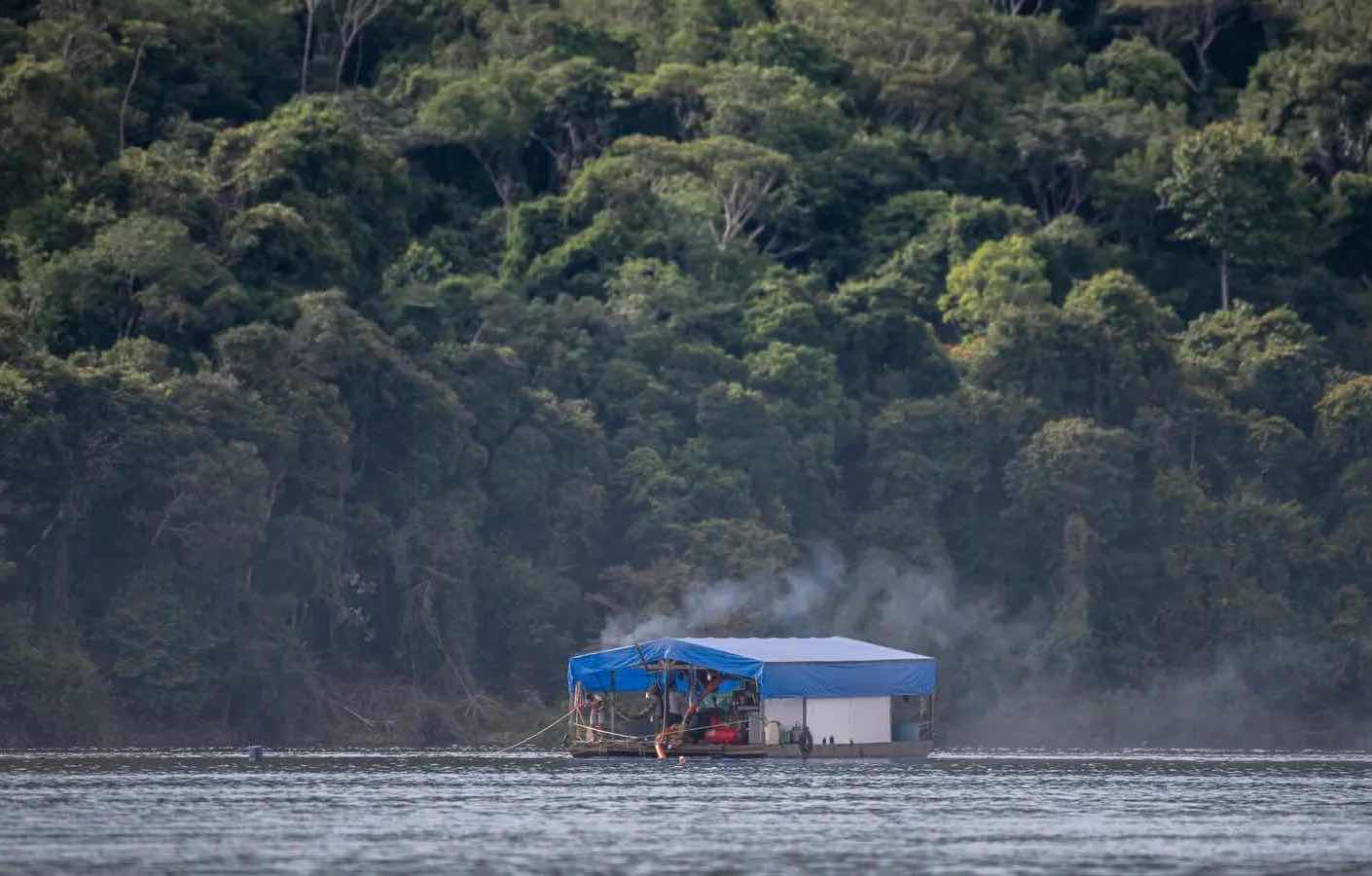
This is an important warning, as small plants make up 80% of the total 275 hydroelectric plants installed in the Amazon. Their licensing is less bureaucratic and they are less subject to the usual controversies that large undertakings face.

Belo Monte, on the Rio Xingu, has become an icon of the last decade. Located near the city of Vitória do Xingu, near Altamira, after just a few years of operation the dam has become more famous for its environmental and social liabilities than for the energy it generates, even though it has adopted the run-of-the-river model. In it, the turbines lie horizontally at the bottom of the river, the reservoir area is reduced, and the volume of water that enters the plant is practically the same as the volume that leaves. From an environmental point of view, it has less impact.

“The problem with this model is that it doesn’t protect water enough. It remains very vulnerable to heavy droughts, which happened in 2021,” argues Jansen Zuanon. “So there will be more pressure for new reservoir projects or reservoirs in series, like we have on the Tapajós.”

To make things worse, climate models are pointing to changes in rain patterns, with less rain in the eastern part of the Amazon which is exactly where Belo Monte is located. Zuanon warns that in order to maintain minimum turbine function, more water will have to be diverted from Volta Grande, the highly scenic region flooded by the dam.

A survey carried out by the Instituto Socioambiental together with the Juruna people evaluated the recent hydrological cycle of the Xingu and found, among other factors, a drop in fruit production on the plants in the local igapós, or flooded forests. This resulted in less food for turtles and tambaquis, meaning less food for the people living there.

“For the indigenous people, the question is basic: if there is no more food for the fish, there will be no more fish to eat,” says biologist Camila Cherem Ribas from INPA’s Board of Biodiversity and Scientific Biological Collections Program.

Madeira river is another giant facing the threat of hydroelectric dams. The huge Jirau and Santo Antônio dams have been operating near Porto Velho in the state of Rondônia since the last decade, and two new hydroelectric plants are included in the 2050 PNE as part of binational agreements with Bolivia.

According to the Dam Environmental Vulnerability Index (DEVI), developed by geologist Edgardo Latrubesse and other authors, the Madeira is named the most vulnerable river in the Amazon. And a study by Latrubesse published in Nature in 2020 points out that a total of 16 hydroelectric projects threaten the upper Madeira.

placeholder-content (important)

Amazon River Basin:

7 million

square kilometers of basin

9

Nations

18%

of all the fresh water that reaches Earth’s oceans

placeholder-content (important)

Gold: Amazonian dream turned environmental nightmare

the Madeira region around Porto Velho was once one of the world’s most productive regions for alluvial gold mining. Construction of the dams left the extraction area flooded and made licensing of mining projects impossible.

This means there are still hundreds of dredgers in the city or upriver that scour the riverbed without mining authorization or environmental licensing. In this illegal mining model, dredgers suck material from the bottom to filter and separate the gold using mercury. The contaminated water is then dumped back into the river.

This “Floating Gold Rush” intensified with the 2020 economic crisis, with shrinking fish stock, and the lack of environmental controls. In the Humaitá region, many fishermen quit their trade to take up gold mining, which is both more profitable and more polluting.

Mercury used to separate the metals contaminates water and destroys food chains. “Mercury tends to accumulate in the bodies of organisms and grow exponentially in the chain. Predators accumulate more. Then problems spread throughout the basin, resulting in lost diversity and ecological functions in every local community,” says Jansen Zuanon.

Edgardo Latrubesse is among those who defend the presence of a regulated activity subject to certain limits, laws, protocols and quotas. He maintains that the problem is not mining itself, but the techniques that clandestine miners use to extract the gold and the fact that they do it inside conservation units and indigenous lands.

“The system could be changed to lessen the impact. Techniques for extracting gold without using mercury exist,” says Valdenira Santos, a researcher at the State of Amapá’s Institute for Scientific and Technological Research (IEPA) and professor at Amapá Federal University (UNIFAP).

It is a complex and sensitive debate - in the world of mining, history has shown that what happens in the real world never corresponds with good theories. In February of this year, the federal government launched a program to formalize and bolster artisan mining in the Amazon—an initiative met immediately by protests from scientists and environmentalists.

“Although mining can be done without using mercury, it’s still completely distant from the reality in the Amazon,” points out Cecília Leal. “Without a major change in mining culture, the activity will tend to continue generating significant environmental and social impacts.”

placeholder-content (important)
img-fit-cover

A river dweller crosses a plain flooded by the Rio Croa in the state of Acre. Flood plains and flood forests have always been the most inhabited parts of the Amazon because of their rich soil. Photo by André Dib.

Flooded forests: legendary landscapes of the Amazon

the dams of the big plants become especially serious in Madeira because of a vital element for the health of the biome: sediments. Almost 90% of the sediment in the Amazon system comes from Andean tributaries. “The most important sedimentary portion of the entire Amazon Basin is located in the Ucayali, Marañon and Madeira rivers,” observes Latrubesse.

Particulate matter from different mineral origins like erosion or decomposing organisms, sediments work as natural fertilizer in a watershed and have vital functions like transporting nutrients and controlling lateral migration rates. In the Amazon, they are responsible for the fertility of the floodplains, unique ecosystems that cover about 14% of the basin.

Várzeas [floodplains] and igapós [flood forests], unique to this immense tropical environment, have been protecting life and habitats for millennia. They depend on the local flood pulse—which is determined by rainfall at the headwaters of the basin’s main rivers. This determines the level of annual floods and droughts.

“These have always been the environments most occupied by human populations in the Amazon because of the nutrient-rich soil, even in pre-Columbian periods,” says Jochen Schongart, an associate researcher on the Board for Environmental Dynamics Research (CODAM) at the National Institute of Amazonian Research (INPA). These fertile inland regions are where most of the rural communities lie.

Flood regions are particularly vulnerable to deforestation or overfishing, as well as climate change and El Niño and La Niña phenomena, which intensify the level of rainfall and droughts. MapBiomas data released in September 2021 point to an increased drought trend in floodplain areas.

“When we don't have the forest that mitigates them, droughts and floods become more intense. If the stream silts up, it overflows even more,” says Raimunda Lucineide Gonçalves Pinheiro, a professor at the Institute of Education Sciences Institute at Western Pará Federal University.

“The floodplain is plentiful,” says Pinheiro. “It has many fish and is fertile for growing food: bananas, watermelon, melons, vegetables. During the flood season, the lakes where fish are caught mix with the river, which floods over into the forest. Fish go into the forest to spawn and feed on the fruits that fall from the trees.”

The amount of sediment deposited at the mouth of the Amazon is estimated at 1.2 billion tons per year. Part of the material released by the river feeds the coast up to Venezuela, forming the largest belt of mud bars in the world. Part of this is retained on the platform in Amapá.

“If the amount of sediment decreases, there is a deficit of material on the platform and along the coast of neighboring countries,” says Valdenira Santos. Less sediment combined with strong hydrodynamics in the ocean will accelerate erosion processes near the mouth of the largest river on the planet.

Biodiversity tries to adapt to these changes in morphology, drainage network and hydrology. “But invasive species, such as the Malaysian shrimp, which are brought in with ballast water on cargo ships, are already being seen at the mouth of the river. This can have an impact on the redistribution of species,” adds Santos.

Specialists’ main concern is with the retention of sediments by large dams, especially in the Madeira basin. “If the entire flow of sediments from the Andes were blocked,” laments Latrubesse, “the Amazon system could die completely.”

placeholder-content (important)
img-fit-cover

Flamingos (Phoenicopterus ruber) fly over Lago Bonome. Migratory birds frequent Cabo Orange National Park, one of the most preserved in the state of Amapá. Photo by André Dib.

The future: a coordinated effort for the basin

in the intricate plot of evolution in tropical regions, “South America has the most diverse cast of species. The Amazon Basin provided ideal conditions for the irradiation of life in an almost unbelievable number of niches,” wrote researcher Michael Goulding in his book The Fishes and the Forest: Explorations in Amazonian Natural History.

Comprehensive assessment of degradation on a continental scale area is a challenge for scientists. There is no coordinated data network for the entire Amazon hydric system, much less an institution or government agency working to conserve the entire basin. More: data surveys or eventual conservation plans do not only involve the Brazilian Amazon. Any activity in the neighboring countries which also compose the basin—Bolivia, Colombia, Ecuador, Venezuela, Guyana, French Guiana, Peru and Suriname – will affect Brazil, as the water flows through to the Amazon.

Within the basin, areas protected by national legislation remain as one instrument of conservation. Another is environmental licensing regulations. Castello remarks that they are important, but do not aim to protect aquatic ecosystems. “It's a big puzzle,” says the researcher.

The lack of a channel for dialogue between scientists and planners makes the scenario even more complex. In Valdenira Santos' view, the solution lies in joining three complementary forces: inspection and monitoring; watershed and land use by companies and the population; and research. “Without joining these efforts and interests, there will be no change.”

“We need solutions, because we clearly have problems,” says Cecília Leal. For her, focusing on regions whose natural characteristics are still intact is key. “It is much easier to preserve than to restore. Impacts are difficult to reverse.”

Recent studies, says Leal, show that the conservation of freshwater environments helps maintain biodiversity – including species on land. “It is time that we look at aquatic ecosystems not just as water resources, but in a more generous and integral way.”

placeholder-content (important)

Explore the Amazon Water Impact Index

Click on the micro-basins to view stats on the most affected regions, according to the index. Activate and deactivate the layers of impact to compare different human activities.